RoScan 3D
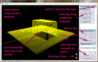
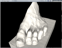
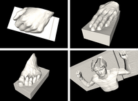
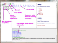
RoScan 3D is a software package, which allows capturing high-resolution 3D models of various objects with various size and complexity using Robotic 3D Scanner. It provides all the neccessary functions for scanner control and configuration, 3D model capturing and captured model visualization.
Main software features are:
- Easy model capturing on one click using predefined scanning trajectories
- Fully configurable scanning trajectory allows capturing of very complex objects including concave surfaces
- Allows saving both raw data in form of point-cloud or in form of shaded model
- Manual measuring of single profiles
- Primarily intended for use with Epson C3 robotic manupulator and laser scanner MicroEpsilon scanCONTROL 2750 or SICK LMS 400 (drivers included)
- Easily extendible for various configurations of robotic manupulator and laser scanners (requires device driver implementing specified interface only)
This software requires Microsoft .NET framework 4 or higher already installed on target computer. Software is still alive and its updates are prepared.
3D models captured with this software can be analyzed with RoScan Analyzer. Follow this page to download RoScan 3D and RoScan Analyzer in one package.
Latest version
Version number: 1.0.0.0
Release date: December 2013
Licence: freeware
size: 1.21MB, last modified: 19.08.2014
Acknowledgement
This work was supported by the project CEITEC - Central European Institute of Technology (CZ.1.05/1.1.00/02.0068) from European Regional Development Fund and by junior inter-faculty research FAST/FEKT-J-13-1987 "Matrix optical sensors data fusion" of internal grant system BUT.


