
The uOg method
Fully digital method uOg for orienteering mapping is result of my long-lasting experiments with the latest devices available on the market. My effort was focused on:
- Increase precision of orienteering maps
- Simplify measuring of base polygons (paths, vegetation boundaries, etc.)
- Simplify mapping in dense areas and other areas with difficult accessibility
- Decrease mapping time-costs
- Simplify actualizing of already mapped areas
Principle
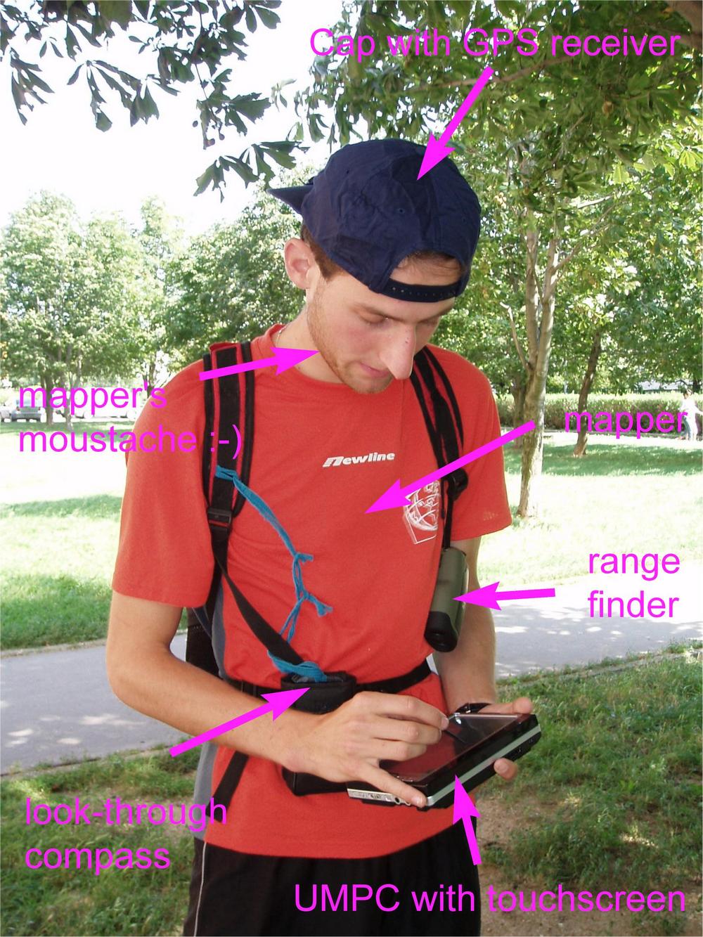
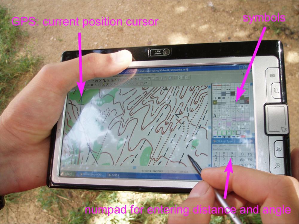
The uOg abbreviation means connection of UMPC, OCAD and GPS. The UMPC is computer of PDA size, but based on x86 architecture, what means that use of standard desktop Windows operating system (Windows XP) is possible.
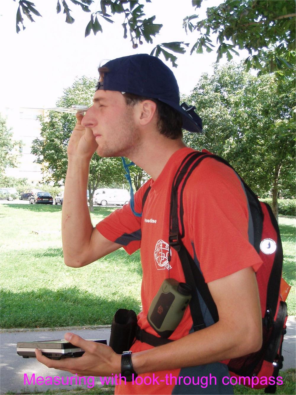
This configuration allows direct instalation of OCAD application, what is big advantage of this method, because no subsequent converting is required. Distance is measured by laser range-finder and angle is measured by look-through compass. These data are entered to OCAD by touch screen which eliminates influence of inaccuracy when drawing polygons, which is the major source on inaccuracy.
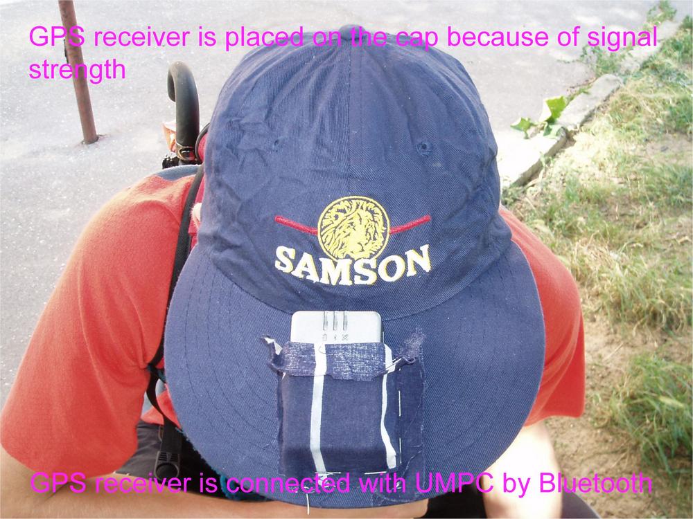
GPS is surprisingly seldom used, because the accuracy in deep valleys and decidious forest is very poor. But in winter in decidious forest or in dense coniferous forest the GPS accuracy is very good. Mapping in these areas is very difficult, so the help of GPS is significant in this case.
Device is cable-connected with batteries, which are placed in the backpack. GPS is wireless connected via Bluetooth and receiver is placed in the pocket on the top of the hat because of signal strength.
Comparing uOg with standard mapping
| uOg method | standard method |
| polygonal position accuraccy up to 2m | position accuracy depends on mapper experiences, but still higher then 2m |
| high drawing precision independent on handicraft | drawing precision very depends on mapper's handicraft |
| fully usable map after forest measuring, no redrawings | time consuming and mistake susceptible redrawings |
| you see exactly the same as competitor - better representation of important features | unreal size of symbols, unreal colors - representation of important features in fact came up later at home! |
| zooming and switching between ground materials - more informations acquired | amount of acquired information based on resolution of printer and sharpness of mapper's eyes |
| easy object erasing | surroundings of erased object is damaged during erasing |
| very easy actualization of already mapped map | actualization takes more than 4 times more of time comparing with uOg |
| more confortable work in winter | frozen fingers must perform very accurate drawings |
| battery capacity "only" for 15 hours of work | depends only on mapper's endurance |
| weight of batteries 1 kg | no batteries |
| Unconfortable mapping in rain | More confortable mapping in rain |
| purchase costs about 750 EUR | purchase costs about 80 EUR |